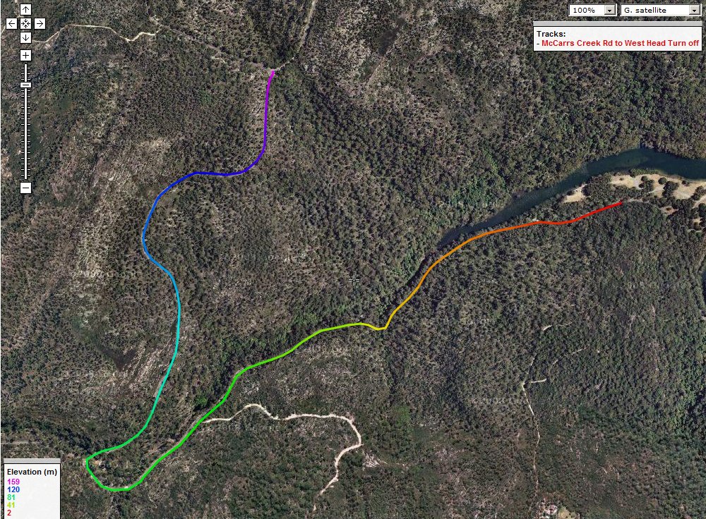
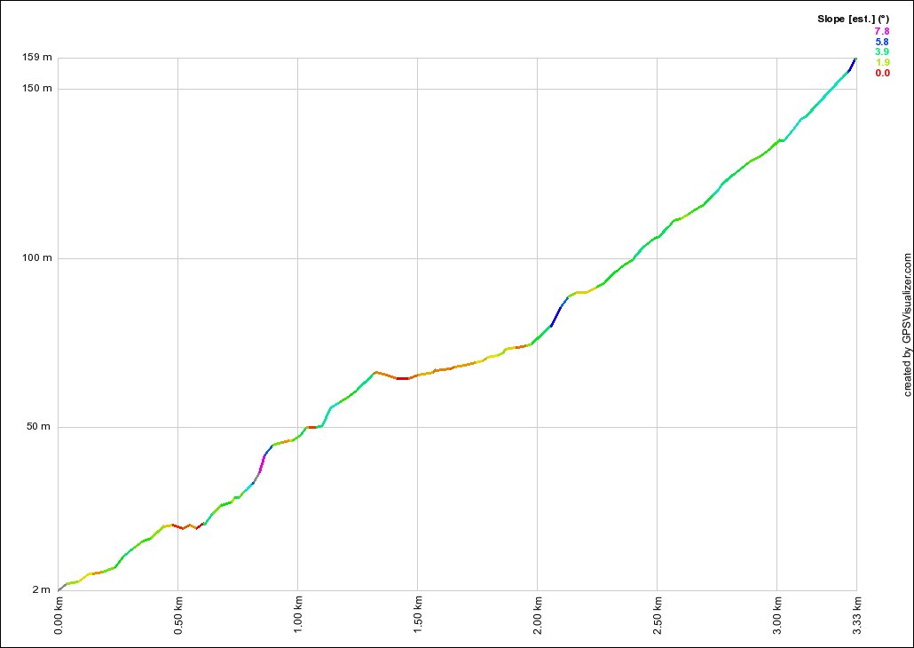
McCarrs Creek Rd/West Head Rd
- Distance:
- 3.33km
- Elevation:
- 157m
- Average Gradient:
- 4.7%
- Start Point:
- National Park Sign
- End Point:
- Coal and Candle Dr
- Regroup Point:
- n/a
- Climb Description:
- After the rolling hills from Church Point, you finally get to a decent climb. It slowly ramps up and does get to a reasonable gradient initially. The road surface is in good condition, but be aware that it is only single lane, and if the group stays bunched, you can get some irate motorists stuck behind you.
Follow McCarrs Creek Rd until the West Head/Akuna Bay turn off, take this right hand turn and keep going up the hill to the West Head turn off. Take the left and descend into Akuna Bay.
There is no regroup point here as there is another climb (Akuna Bay North) later on.