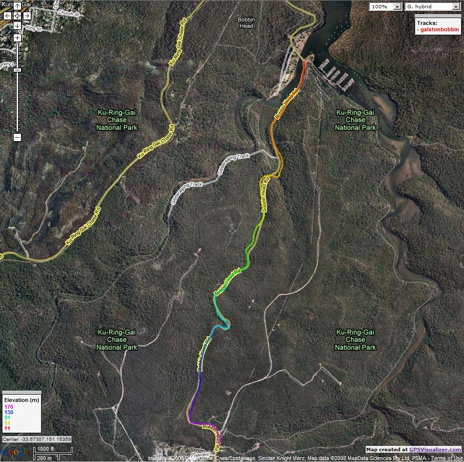
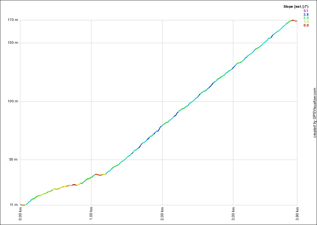
Bobbin Head South
- Distance:
- 3.9km
- Elevation:
- 159m
- Average Gradient:
- 4%
- Start Point:
- Bridge
- End Point:
- Toll Booth
- Regroup Point:
- Outside the School
- Climb Description:
- This is another favourite climb among cyclists in the area. It starts off nice and gently, and then picks up to a slightly steeper gradient, but not an extreme one.
Often the group will ride the first section steadily and in formation, it is only when the road points more upwards do the stronger climbers start to show off their talents.
Despite being in the middle of Northern Sydney, it is easy to imagine that you are in the middle of nowhere as you are surrounded by bushland. The scenery is spectacular and makes the climb very enjoyable.
This is yet another climb where local knowledge can increase your chance of taking the points. Knowing where to sprint for the KOM can allow you to open the surprise gap that others try to close too late.
The regroup point is about 200-300m past the Toll Booth at the parking area of the School.